")
Specialist despite myself: An interview with Jacques Dassié
- Last Updated: Wednesday, 26 October 2022 12:11
- Published: Wednesday, 26 October 2022 12:11
- Written by Justine Janpaule translated by Rupert Salmon and Maura Schmitt
- Hits: 1099

ArkeoTopia initially contacted Jacques Dassié when he participated in the 2017 edition of the Wiki Loves Monuments photographic contest. On the occasion of the 2020 edition, our journalist Justine Janpaule grabbed her chance for an exclusive interview to find out more about his beginnings as a French pioneer of aerial archaeology. We take a look back at his passion that came about by chance and resulted in photos that will benefit the entire scientific community when they are released on Wikimedia Commons in a few months’ time.
The birth of aerial archaeology
in Poitou-Charentes
An interview with Jacques Dassié

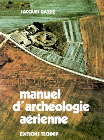 "This activity came about quite accidentally," says Jacques Dassié, a specialist in aerial archaeology and the discoverer of various archaeological sites, such as the well-known Saint-Georges-du-Bois amphitheater, and the vestiges of a Gallo-Roman town at Barzan, which are the subject of significant excavations and research in France and elsewhere. Following these discoveries, in 1978, Dassié defended a thesis on aerial surveys at Sciences Po in Paris. Work on this approach to archaeological study was published in his Manuel d’archéologie aérienne (Book About Aerial Archaeology), which was followed by an edition showing photographs of the Charentes region that Jacques Dassié has flown over thousands of times. His work is also available online on his website, as well as on other platforms such as Wikimedia Commons.
Could you describe your background in aerial archaeology?
 In 1962, as a young pilot and amateur photographer, I was out on a Sunday plane ride with a friend, flying toward Royan, on the Atlantic coast, when I saw some unusual traces in a field. When I reviewed the pictures later, I was taken aback: they contained geometric shapes, circles, that could absolutely not have occurred naturally! I had to know what their origin was. From there, I went on a great number of searches for more clues.
Then, I gradually developed a methodology for oblique aerial photography. I checked up with the archaeological authorities who helped me and immediately issued an aerial survey authorization. I had, in fact, without knowing it, discovered a protohistoric necropolis.
When did you start publishing your findings?
 My surveys, which were always self-financed, provided me with more and more results. It became urgent to publish them in order to ensure the dissemination of these discoveries. My work achieved a certain renown and I began to get many requests for conferences and exhibitions. I had become a specialist despite myself!
During an international exhibition in Amiens, in 1972, Professor Raymond Chevallier approached me and suggested I prepare a thesis under his supervision. It had to relate, of course, to aerial archaeology. Flattered, I accepted, and that's how I started my academic study of the subject, navigating through a degree from the École des Hautes Études en Sciences Sociales in Paris, to a DEA (postgraduate degree) at the university of Tours, then to a doctorate in 1978, also from Tours. A long period followed with a number of major discoveries
What are the trends in aerial archaeology today?
 There has been a huge amount of work to be done since satellite imagery was made available to the public. Anyone at home can search for important sites and ancient roads. Little explanation is needed to get started: mostly how to read the coordinates of an image and record its location. Google, for example, allows you to do this.
In the field of aerial archaeology, enormous progress has been made using LIDAR. This laser radar device’s importance lies in its ability to penetrate into the ground, into foliage, and into any domain inaccessible to simple photography. But the drawback of this marvelous machine is its cost. This limits it to state users and places it out of the reach of private users for the time being.
What is the procedure of your work? First, how do you identify which places to photograph, as this is essential for archiving in archaeology?
 The first step is to prepare for the flight on the ground. If we wish, for example, to search for Neolithic Charentais camps, experience has taught us that these sites are generally in a defensible location near a source of water. We will therefore choose to explore the hydrographic network of a small river, for example the Né, in Charente. A map collection showing the area at 1/50000 will have been prepared in advance.
After the plane has been readied, we will choose a take-off time when the sun is already quite high (it is best to avoid small valleys in the shade, which are difficult to photograph). And then, the surveyor will let himself be guided by his instinct, jumping from one outcrop to the next, not worrying about going in a straight line and snapping away (photos are free, whereas the hour of flight…). This results in a flightpath the layman might consider incoherent. But it is definitely effective.
Important discoveries have been made in the Charente-Maritime department, including the Saint-Georges-du-Bois amphitheater and a Gallo-Roman town at Barzan. How did you find out about Barzan?
 My wife is Charentaise, so I wanted to learn more about the history of her native region. We went to the Génie library in Paris to consult the documents left by Claude Masse (1652-1737), an engineer and geographer to the king. In particular, the Carte générale de partie des costes du Bas-Poitou, pays d’Aunis, Saintonge et partie de Médoc (A Map of Part of the Bas-Poitou Coast, the Aunis Region, Saintonge and Part of Médoc), a fantastic record, abundantly illustrated by the author.
It was, after all, Claude Masse who wrote of his observations made from the top of the hill La Garde: "From here, one can clearly see the ruins of a city which was, they say, famous." This says it all. If a royal engineer-geographer took the trouble to write this down, we had no reason to doubt it.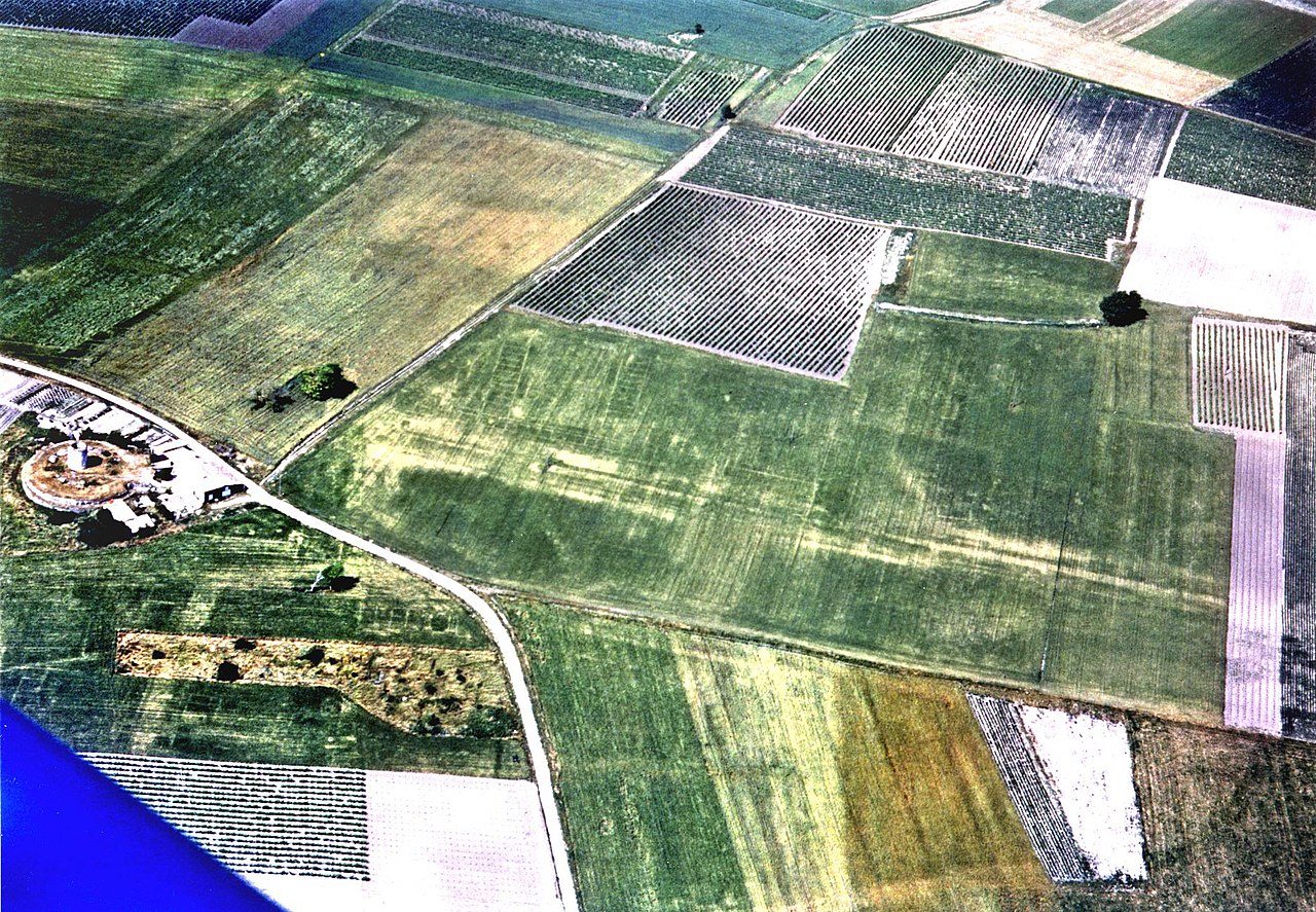
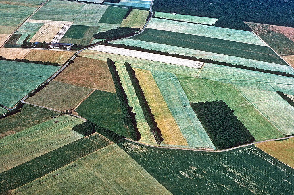
 The conclusion was obvious: the city had existed, but we had to track it down! I undertook aerial surveys over the Barzan-Talmont area six to eight times a year. For thirteen years, we saw nothing but very homogeneous crops on those plains... Then a miracle occurred. On June 26, 1975, (a year of great drought, preceding that of 1976) all the necessary conditions (meteorology, nature and humidity of the soil, nature of crops, state of development of cereals, time of survey, etc.) aligned and were favorable: marks appeared in the yellowing cereals! It was all there! The “Grande Avenue,” which linked the Fâ, a large temple surrounded by a peribolos, to another group of temples at the bottom of La Garde hill. Large alignments of identical rooms betrayed the presence of horrea, storage facilities and state warehouses: clear signs of the existence of a port! Monumental ensembles surrounded a forum, as is so characteristic of a Roman city!
Unfortunately, it took twenty years for a university to finally take an interest in it. It was in 1995 that Professor Pierre Aupert of the university of Bordeaux III, intrigued by the extent of the routes and their historical import, became involved and began scheduled excavation campaigns.
Are excavations still continuing on the Barzan site?
 In 1993, the Association for the Protection of the Archaeological Site of Barzan (ASSA Barzan) was created. However, it was only in 1999 that a “Syndicat Mixte” bringing together the municipality of Barzan and the Department was in turn created. With the ASSA Barzan, this new institution gave legal status to this site. After that, the excavations continued without interruption.
Other universities followed suit, which led to the universities of Poitiers and La Rochelle, as well as the CNRS, getting involved in the research.
Learn more
- Find Jacques Dassié's work on his personal website www.archaero.com
- Discover his free license photo library in the Jacques Dassié category on Wikimedia Commons
- Learn more about, in French, the Gallo-Roman Museum and Site of Fâ in Barzan (17120)
Would you like us to do an interview, a book or documentary review, or another type of review relating to archaeology, whether for the general public, for children or for specialists? Write to us thanks the form.
ArkeoTopia, an alternative approach to archaeology® aims to take a fresh look at the archaeology of today to better help existing organizations prepare for the archaeology of tomorrow. To learn more about the organization, feel free to check out our institutional video and our activities.