")
Photography Techniques in Archaeology
- Last Updated: Tuesday, 28 June 2022 07:49
- Published: Friday, 29 April 2022 15:42
- Written by Jean-Olivier Gransard-Desmond translated by Leah Gallet
- Hits: 2481

Join Augustin, Alex, Lisa and the whole ArkeoTopia team to discover additional resources for step 5.5 in My Archaeology Book about photography techniques in archaeology.
Step 5.5 - Fieldwork
Photographing an Archaeological Find
Corresponding pages in MAB1 and MAB2
MAB1 p. 20 and MAB2 p. 26-27
More about this step’s reference artifact
The drawing in My Archaeology Book titled Photographing an Archaeological Find was inspired by an Iron Age silo from the rescue excavation of an Intercommunal economic activity park (Parc d’activités économiques intercommunal or PAEI), in Obernai, France. This step explains the usage of photographic techniques specific to archaeological research.
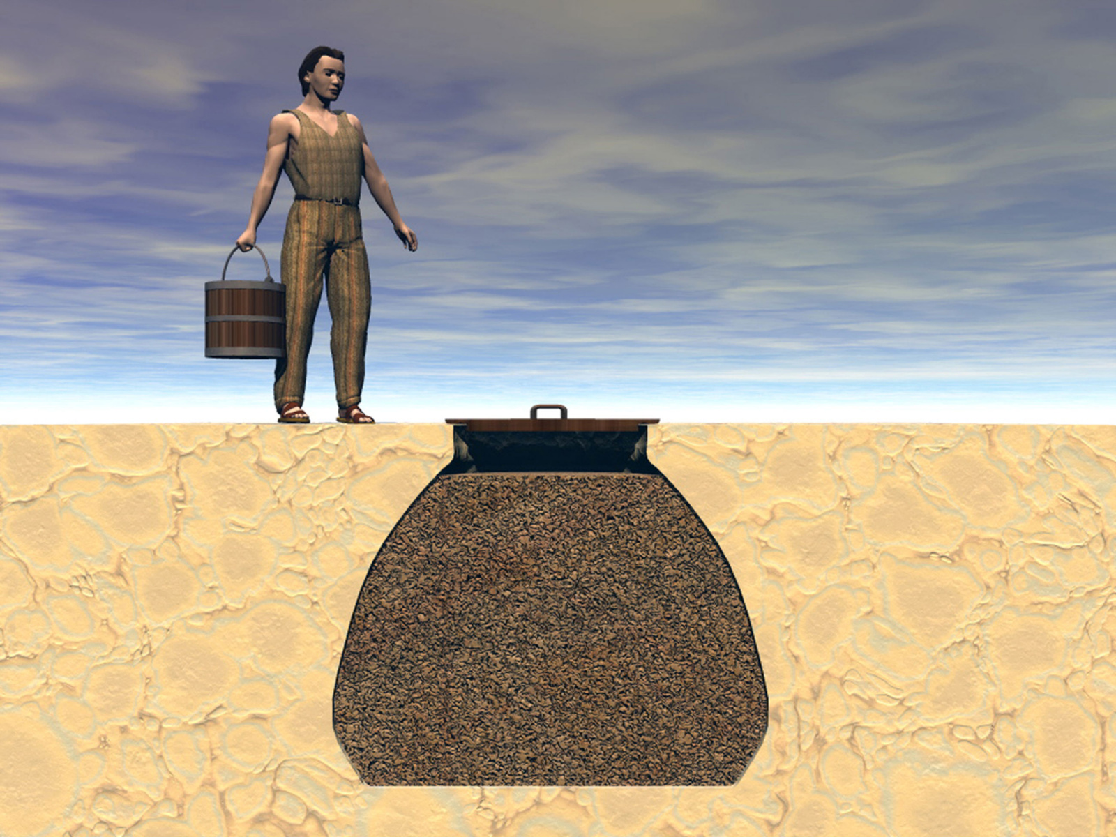
A team from Rhineland Interdepartmental Archaeology Center (Pôle d'Archéologie Interdépartemental Rhénan), led by the chief operating officer François Schneikert, conducted the rescue excavation of the PAEI site from March 26 to April 24, 2012 in Strassburger Pfad, east of the Obernai urban area. The operation revealed disjointed periods of human occupation from the Neolithic period up through Antiquity, including one from the early La Tène period around 520-425 BCE, which inspired the drawing in My Archaeology Book. Among the archaeological remains left by human activity, there are more than just artifacts. There are also traces left on and under the ground which cannot be preserved in a museum. This is true for silos, which are many times just a hole that was dug directly into the ground. A silo is a structure used to store food such as grain. Structure ST125, shown here, which served as a model for the archaeological finds photographed by Alex, is a silo dug into the ground to store grain. The silo was filled up over time, either by the inhabitants of the time or by erosion.
Photographers who work with archaeologists, or the archaeologists themselves acting as photographers when lack of funds makes it impossible to have a professional photographer on site, must follow a detailed protocol when documenting archaeological remains. Any single survey or excavation requires hundreds or even thousands of photographs. It is therefore necessary to have a means to identify them after the fieldwork has been completed. The best identification method is to note the name of the site, the name of the structure, and the date of the photograph, as well as the dimensions and orientation used by the photographer.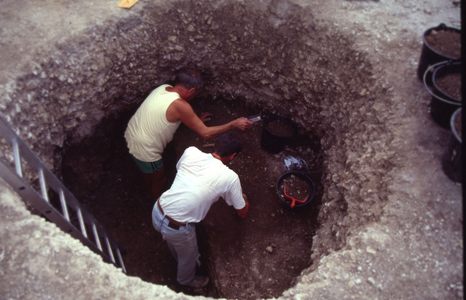
 The identification process for on-site photographs proceeds as such: using a letter board, the photographer indicates the location, site name, structure, and date of the photograph; then a photographic reference scale is placed in the frame as well as an orientation arrow pointing North. The photographic reference scale gives an idea of the dimensions of the archeological find. It is a kind of ruler, used to indicate the relative size of what is being photographed, althought measurement scale does not look like that of a conventional ruler and is instead made up of several colored blocks. The orientation arrow indicates where the camera was positioned in relation to the North.
Once all of this has been completed, one challenge remains: how to differentiate between the soil inside the silo and the soil that surrounds it? Photographers and archaeologists have had to find solutions to these kinds of problems that are specific to field survey documentation in addition to the steps outlined in the aforementioned procedure. In this particular case, in order for the silo to appear in the photograph, photographers and archaeologists have found that spraying water around the silo brings it into focus. By darkening the color of the soil between the inside and outside of the silo, the circular shape of the latter is highlighted without destroying the archaeological remains inside (water can damage some porous or wooden archaeological remains). The structure can thus be more easily captured by the camera lens. This entire procedure allows archaeologists to keep a record of the silo’s existence before it is destroyed by the rest of the excavation.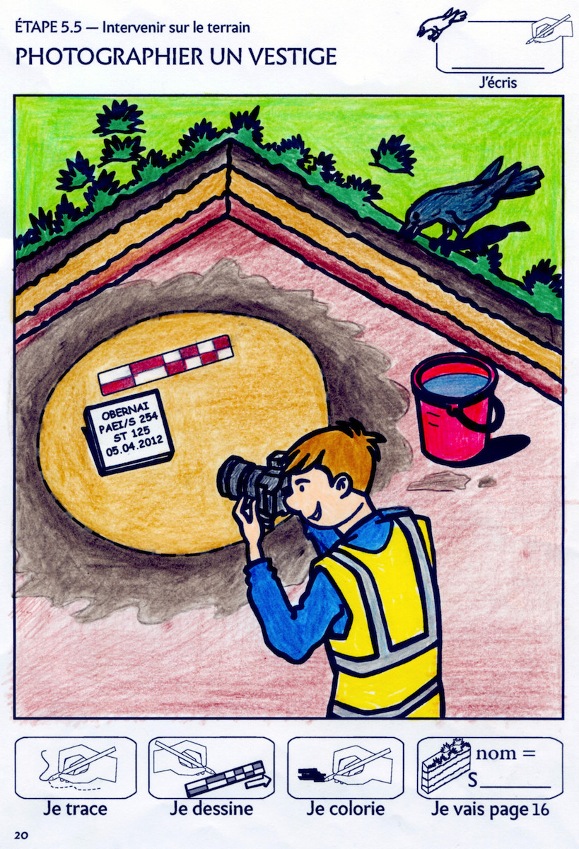 As shown in the drawing, the archaeologist, Alex, first setup his letter board, his photographic scale, and his orientation arrow. Then, in order to make the Obernai silo more visible in his photograph, he made sure to bring a bucket of water (this object is more easily recognizable by children than a spray bottle, although the latter is more typically used by archaeologists). The water is used to wet the entire outer rim of the cylindrical hole made by the silo, resulting in a difference in soil color. This is why Chris, who colored the drawing, used dark brown to color the outer rim of the circle and light brown for the inside. Now, Alex can photograph the structure under the watchful eye of Cortex the crow.
Glossary
A field survey is the inventory of all archaeological remains within a defined surface area, as determined based on drawings, photographs, fieldnotes, and/or 3D scanner images.
A trace is a series of prints or marks left by the passage of a living being, either through wear or otherwise. In archaeology, each of these prints or marks is a clue to better understanding human History.
Clues
The 8 clues include:
- Alex, the archaeologist, represents a scientist working on an excavation site.
- The camera, which is one of the devices used by the scientist to photograph an archaeological find.
- The bucket filled with water, used to wet the area around the archaeological feature in order to highlight the colors of the soil, is another tool that helps the scientist photograph an archaeological find.
- The letter board, which contains information on where, when, and which archeological finds correspond to the photograph, is another tool for the scientist taking photographs of an archaeological find.
- The photographic reference scale, used to provide the dimensions of the archaeological find, is another tool for the scientist to photograph an archaeological find.
- The arrow pointing north, used to indicate the orientation of the archaeological remains, is another tool for the scientist to photograph an archaeological find.
- The circular line showing the Iron Age silo (a human construction, in this case made of earth, used to keep food fresh) is the archaeological feature being photographed by Alex.
- Cortex the crow, who represents human intelligence and here, the scientist’s ability to find solutions to photographically document an archaeological feature made of earth in the middle of the ground - by wetting the area around the silo, the silo itself is then highlighted.
Land-Based ExcavationMy Archaeology Book
Resources HomepageStep 5.6 - Fieldwork
Labeling Techniques
 |
 |
|
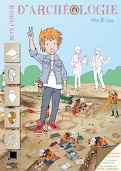
My Archaeology Book 1 |
My Archaeology Book 2 |

 My Archaeology Book, or MAB, is an activity workbook that combines creativity, fun and learning. Alongside young Augustin, a curious and courageous boy, children meet Alex and Lisa, two friendly archaeologists who will lead them to discover archaeology and French heritage. Each drawing illustrates a situation that Alex and Lisa might encounter at work. Depending on the age of the child and the workbook, children follow easy-to-understand symbols in order to experiment with activities such as coloring, drawing, observation games, riddles and reading in order to see the world through an archaeologist’s eyes. Alone, with family, at school or just for fun, children expand their knowledge and gain skills, all while having fun.
On this section, you will find additional resources: color photos of archaeological documents that inspired My Archaeology Book, additional teaching documents (flip-book, websites, suggestions for classroom use, edutainement, etc.) and information on upcoming publications. Each page will be updated over time.