")
Finding Archaeological Sites via Satellite
- Last Updated: Tuesday, 28 June 2022 09:27
- Published: Thursday, 14 April 2022 10:41
- Written by Jean-Olivier Gransard-Desmond translated by Maura Schmitt and Leah Gallet
- Hits: 1593

Join Augustin, Alex, Lisa and the whole ArkeoTopia team to discover additional resources for step 2.3 of My Archaeology Book about locating the former presence of human beings via satellite surveys.
Step 2.3 - Locating Archaeological Remains
Using Satellite Imagery in Archaeology
Corresponding pages in MAB1 and MAB2
MAB 1, p. 8 (step 4.2, p. 11 in the 1st edition) and MAB 2, p. 10
More about this step's reference artifact
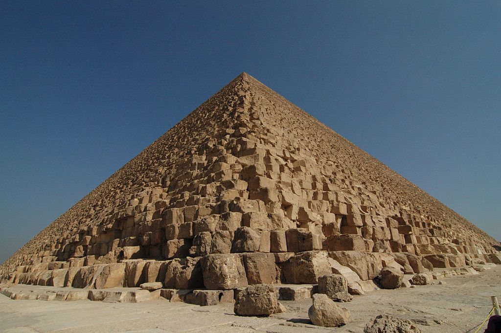 The Great Pyramid of Giza in Egypt, also called the Pyramid of Cheops, served as the inspiration for page 8 of My Archaeology Book, titled Satellite Surveys. Detection via satellite is another method in the archaeologist toolkit that can be used to pinpoint locations where human beings were once present.
The Great pyramid of Giza was built by the ancient Egyptians and became designated as a UNESCO World Heritage Site in 1979 as part of Memphis and its Necropolis. The monument is a pyramid with a square base that is believed to be the tomb of the pharaoh Cheops. According to the American archaeologist Mark Lehner, it was built during the Fourth Dynasty between 2,551 and 2,528 BCE. Near Cairo, the capital of Egypt, located inside the city of Giza, the Great Pyramid is located in the center of the Giza Necropolis and is the largest of the three pyramids in Giza.
To be clear, the Pyramid of Cheops was not found using satellite survey. Many other Egyptian pyramids, however, were found by a variety of Egyptian, American and French archaeologists using this method. To give an example, the BBC video “Egypt: 17 pyramids discovered by satellite” refers to several ancient Egyptian pyramids discovered using satellite surveys.
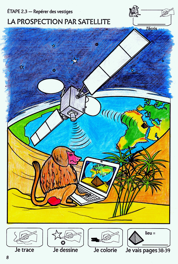
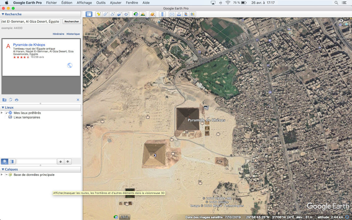
In the workbook, depending on which version is being used, archaeologists are represented either by Thoth, the baboon, or Lisa, the archaeologist. The famed Pyramid of Cheops demonstrates how archaeologists use satellites to locate archaeological sites, or archaeological remains in general, left by human beings without even stepping foot outside the laboratory. Anyone can use the Internet to find satellite images of the Earth on our computers. With tools like Google Earth Pro, one can access images like the picture of the Giza Plateau captured by the ArkeoTopia team. Once the image is found, however, it must be analyzed for anomalies (irregularities regarding the expected pattern which means potential archaeological remains are here). This is a more challenging task than it seems. Despite the difficulty of this undertaking, amateur, and thus untrained, archaeologists also take part in these kinds of analyses.
 |
 |
 Thoth the baboon is a character that represents Egypt well, and not only because baboons are found there. Thoth also symbolizes human intelligence, as he is a depiction of the Egyptian deity Thoth. Revered by Egyptians for the invention of writing and languages, Thoth is the incarnation of intelligence and speech. For this reason, Thoth is shown using a computer displaying an image of the African continent and the Great Pyramid of Giza. This image could only have been collected using signals sent via satellite.
Clues
The 8 clues in My Archaeology Book 1 include:
- The satellite orbiting the Earth
- The extraterrestrial sky with stars
- Signals sent by and to the satellite
- Earth, showing the African continent and the Atlantic Ocean
- Thoth's computer
- The Great Pyramid of Giza, visible both on the African continent and on Thoth’s computer screen, which represents the anomaly Thoth will use to identify the former presence of human beings
- Thoth the baboon, who represents the necessary knowledge and know-how needed by archaeologists to use digital tools intelligently
- The sand dunes and the thicket of papyrus, which show that Thoth must visit the site to analyze the anomalies found using satellite imagery
The 10 clues in My Archaeology Book 2 include:
- The satellite orbiting the Earth
- The extraterrestrial sky with stars
- Signals sent by and to the satellite
- Earth, showing the African continent and the Atlantic Ocean
- Lisa the archaeologist
- The Great Pyramid of Giza, visible both on the African continent and on Lisa’s computer screen, which represents the anomaly Lisa will use to identify the former presence of human beings
- Lisa's computer
- The table and chairs where Lisa is working, which show that her survey is taking place in the lab
- Thoth the baboon, who represents the necessary knowledge and know-how needed by archaeologists to use digital tools intelligently
- The sand dunes and the thicket of papyrus and Lisa’s hat, which show the need to visit the site in order to analyze the anomalies found using satellite imagery
Using FieldwalkingMy Archaeology Book
Resources HomepageStep 2.4 - Location
Using Aerial Survey
 |
 |
|
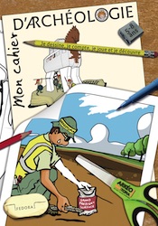
My Archaeology Book 1 |
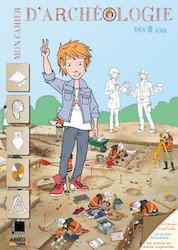
My Archaeology Book 2 |

 My Archaeology Book, or MAB, is an activity workbook that combines creativity, fun and learning. Alongside young Augustin, a curious and courageous boy, children meet Alex and Lisa, two friendly archaeologists who will lead them to discover archaeology and French heritage. Each drawing illustrates a situation that Alex and Lisa might encounter at work. Depending on the age of the child and the workbook, children follow easy-to-understand symbols in order to experiment with activities such as coloring, drawing, observation games, riddles and reading in order to see the world through an archaeologist’s eyes. Alone, with family, at school or just for fun, children expand their knowledge and gain skills, all while having fun.
On this section, you will find additional resources: color photos of archaeological documents that inspired My Archaeology Book, additional teaching documents (flip-book, websites, suggestions for classroom use, edutainement, etc.) and information on upcoming publications. Each page will be updated over time.