")
An Archaeologist Enters Wiki Loves Monuments Contest
- Last Updated: Tuesday, 27 December 2022 14:55
- Published: Tuesday, 27 December 2022 14:32
- Written by Jean-Olivier Gransard-Desmond translated by Maura Schmitt and Jennifer Fahy
- Hits: 939

Discover why the volunteer archaeologist Jacques Dassié participated in the 2017 edition of Wiki Loves Monuments, the largest photography contest in the world, and how this contest and its platform represent key support for archaeological research around the world..
How does a photography contest
contribute to archaeological research?
Wiki Loves Monuments is an international photography contest held every year in September with the support of the Wikimedia Foundation. Its goal is to highlight heritage sites in every country of the world.
Since its creation in the Netherlands in 2010, the event has encouraged people to take pictures of historical monuments and heritage sites, in their region or elsewhere, then upload them to the Wikimedia Commons media library. Contestants can compete in the country of their choice by sharing photographs taken in that country. Anyone can compete in the country of their choice by sharing photographs taken in that country.
According to the Guinness World Records, the 2012 edition of Wiki Loves Monuments set a new world record for the largest photography competition, with 34 participating countries and 353,768 images uploaded between September 1 and October 15. In 2017, Jacques Dassié had the pleasure of contributing to this contest.
Jacques Dassié, would you introduce yourself to our readers?
 Jacques Dassié (JD): I am an electronics engineer and obtained my pilot’s license in 1949. My passion for photography led me to my interest in archaeology in 1962. At the time, I flew around taking photos of the countryside, especially the ground. I was surprised when I saw unusual geometric shapes in my photos and wanted to learn more. That’s how I came to specialize in aerial archaeology in Poitou-Charentes. As my work was of interest to professional archaeologists, I was asked to pursue a doctorate and continue my work in collaboration with the French authorities responsible for cultural heritage, making me a volunteer archaeologist specialized in aerial archaeology. At the end of my “career,” I had discovered over 2,000 sites of human activity.
What is aerial archaeology?
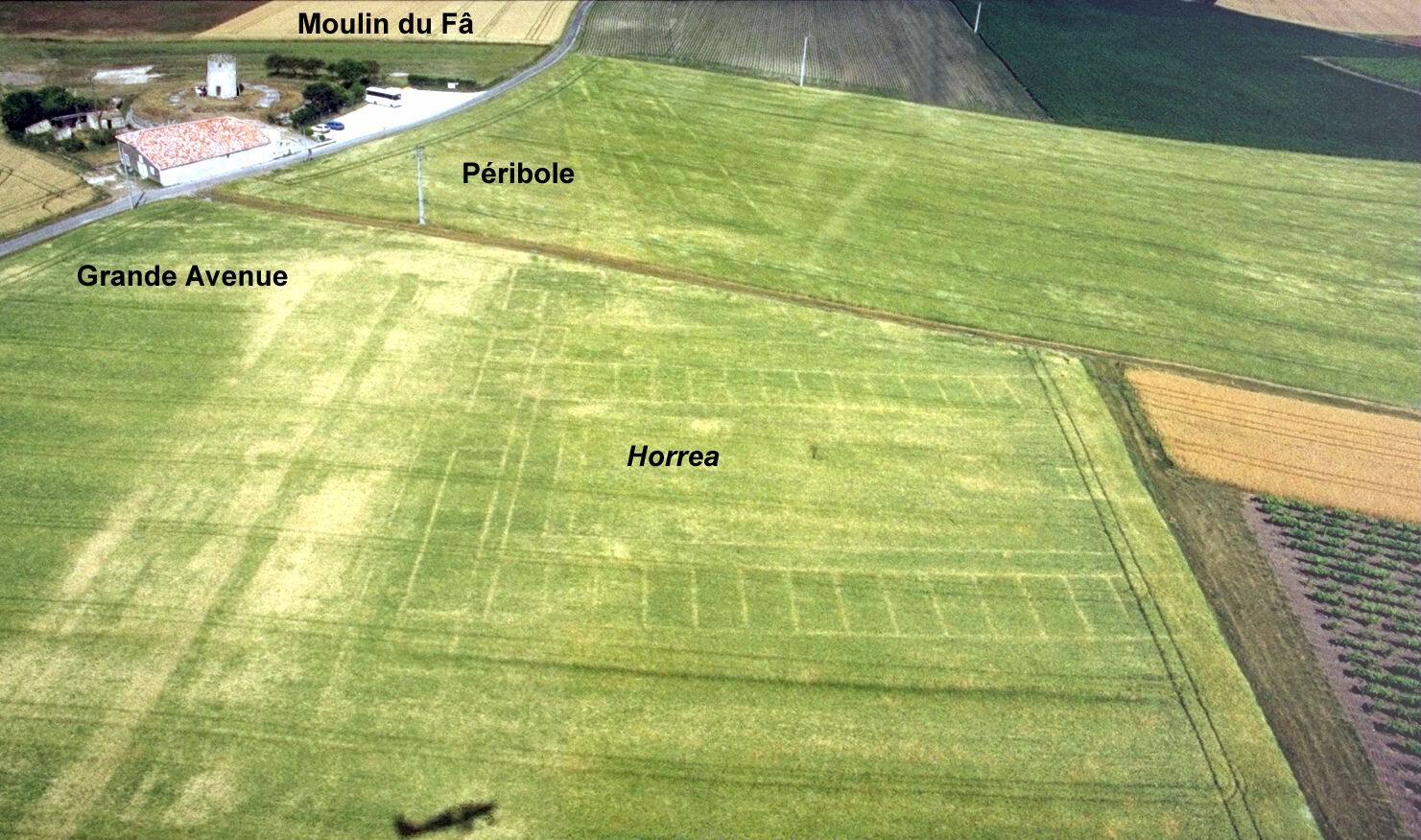 JD: Aerial archaeology is a method of extensive, non-destructive archaeological research. With the oversight of the Regional Archaeology Services (Services Régionaux de l’Archéologie - SRA), which issue survey permits, aerial archaeology entails taking photographs from the sky so as to identify clues of former human activity that are not visible from the ground. This requires very specific weather conditions, environmental conditions, and agronomical conditions for clues to be visible. The altitudes can therefore vary greatly and must be adapted to the size of the subject detected. Traces found in this way must then be analyzed, interpreted and published in order to contribute to a better understanding of our knowledge of different human civilizations throughout History.
In 2017, you participated in the Wiki Loves Monuments contest. What drew you to it?
JD: It wasn’t for personal gain, and I wasn’t trying to win. I merely saw it as a meaningful opportunity to showcase the monuments here in Charentes and a nice way to show them off a bit. I really love this region.
Which photos did you select for the contest? Which criteria did you use to choose them?
JD: I think Wiki Loves Monuments is a wonderful photography contest, which is why I uploaded over 100 images (107 images, ed.). However, I did not take them specifically for the contest. I selected from my photo collection the images that I thought adequately represented the major monuments in the Charente-Maritime. Once again, my goal was simply to share an aerial view of this part of France..
 |
 |
 |
Do you find the Wikimedia Commons tool useful?
 JD: Even beyond the contest, the Wikimedia Commons platform is very useful because it lets users share a large quantity of documents. For example, on my website Archaero, I can only share about ten photos in any given section, while on Wikimedia Commons I can post every photo I have of a monument. And then, seeing the photos published and well-categorized is a huge advantage.
Who requests your photographs?
JD: Most requests come from students preparing dissertations across the world. I interact with archaeology students in Poland, Germany, the United States, Romania and many other countries.
Do you think Wikimedia Commons could be a helpful tool for archaeology?
 JD: Yes, it’s a very helpful tool. It makes accessing aerial archaeology images possible without needing to visit departmental archives or specialized archaeological services. This also makes the chronological identification of sites much more straightforward.
In addition to saving time and money, images are international. Unlike text, images can be understood just as well by an American, Italian or German archaeologist as by a French archaeologist. Wikimedia Commons thus makes scientific data available for use to the entire world.
It’s important to note that the photos are free to use. In fact, you can only upload images after accepting an Attribution-ShareAlike creative commons license. This means that anyone can use these images, for business purposes or not, provided they name the creator. Regardless of what people say, using an image for a scientific publication is a commercial use, even if the author or authors don’t earn anything from it. When you look at it this way, Wikimedia Commons images, which can be used without restrictions, represent a tremendous bank of free scientific resources.
Based on your experience, how can archaeologists use Wikimedia Commons for their research?
 JD: The advantage of Wikimedia Commons is that you can find numerous images organized by category. Then, from one single photo, you have many options.
For example, starting from one online photo, you can trace back to the creator, contact them and request additional information. Creators often have different photographs than those made available online. So using the photos I uploaded during the contest, you can trace back to me and contact me via my Wikimedia Commons user page.
Let’s take the previous example and follow another path. Starting with the photo, you can also use the categories at the bottom of the page. You can either go back to the main category for my uploads or the category for aerial archaeology in general. That one photograph enables you to find many other images on the same subject but viewed from different angles.
Do you plan to upload all your images to Wikimedia Commons?
 JD: I shared my best photos for the contest, so I don’t plan to participate again. However, the publication of the rest of my photo collection will certainly interest specialists. Following my participation in the 2017 contest, which led to this interview with you, this October I have been working with ArkeoTopia to continue uploading my photo library to complement my personal website. I plan to seize this opportunity to share as many photos that are useful to archaeological research as possible.
Interview by Justine Janpaule of ArkeoTopia in April 2020, with support from archaeologist Jean-Olivier Gransard-Desmond as editor.
Learn more
- For more about the Wiki Loves Monuments contest, check out::
- the official international page, to find the websites of other participating countries https://www.wikilovesmonuments.org
- the annual participation statistics for the contest on https://wikiloves.toolforge.org/monuments
- For more about the Wikimedia Commons platform, check out:
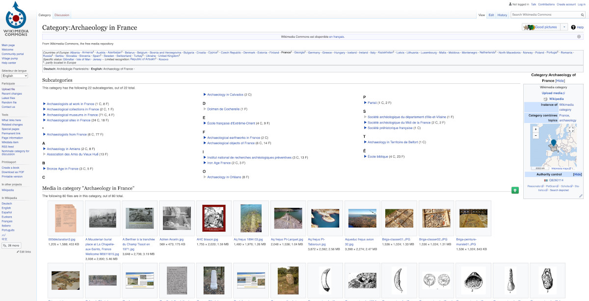
- the Category:Archaeology page, which gathers all the categories and subjects relating to archaeological research imagery, as part of the Wiki Loves Monuments contest or outside of it
- the Category:Museums page, which gathers all the categories of images that were provided by museums or by contributors that captured collections from all over the world
- the working group for “Galleries, Libraries, Archives and Museums", dubbed GLAM which works to promote the museum collections of Wikimedia Commons and is supported in France by ArkeoTopia as part of its partnership with Wikimédia France
- On Jacques Dassié’s personal website, www.archaero.com find some of his photographs as well as anecdotes relating to aerial surveys and information on the sites he discovered.
- In the Jacques Dassié category on Wikimedia Commons, view Jacques Dassié’s photographs introducing himself and explaining his work. This photo library was organized by ArkeoTopia into three main sections: photographs from aerial surveys, photographs of excavations and photographs of heritage sites.
- On Jacques Dassié’s background: the article by Justine Janpaule, "Specialist despite myself: An interview with Jacques Dassié", October 17, 2020, at https://www.arkeotopia.org/en/resources/press-review/590-specialist-despite-myself-an-interview-with-jacques-dassie.html
Would you like us to do an interview, a book or documentary review, or another type of review relating to archaeology, whether for the general public, for children or for specialists? Write to us using the ArkeoTopia contact form.
ArkeoTopia, an alternative approach to archaeology® aims to take a fresh look at the archaeology of today to better help existing organizations prepare for the archaeology of tomorrow. To learn more about the organization, check out our institutional video and our activities.